Brief:
The goal of this hackathon project is to enable the general public to more easily understand public policy on the built environment. This improved understanding is facilitated through Augmented Reality visualized open-source data sets. Land, building, and infrastructure masses can be harvested from open data sets such as CityGML, while zoning, economic, and other jurisdictional information can be found on local datasets such as Data. Seattle and Walkscore, et. al. We proposed to access this data and visualize it through AR onto a given property in order to give insights to the general public about their neighborhood’s future, and to investors for the development potential of a property.
Hackathon Project Statement:
“Our mission is to make public information on the built environment more accessible and digestible. By creating compelling augmented reality visualizations of public policy we raise public awareness and the level of discourse about the world around us.”
Core (MVP) Functionality
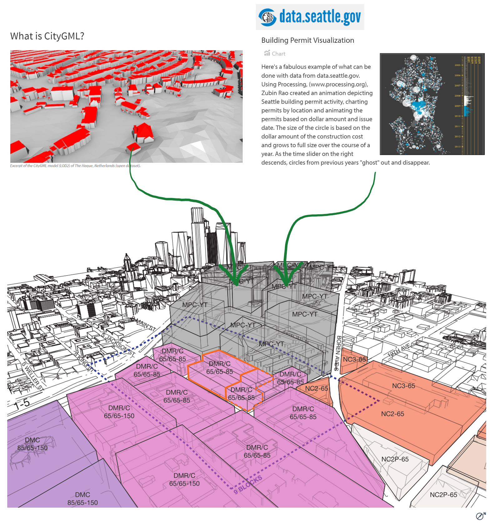
Pull public GIS data based on current geo-location (CityGML)
- Landmass topography
- Streets and walks
- Building mass
- Search functionality
- Image based AR Anchor
- View GIS data in Augmented Reality (Vuforia SDK)
Additional Functionality (time allowing)
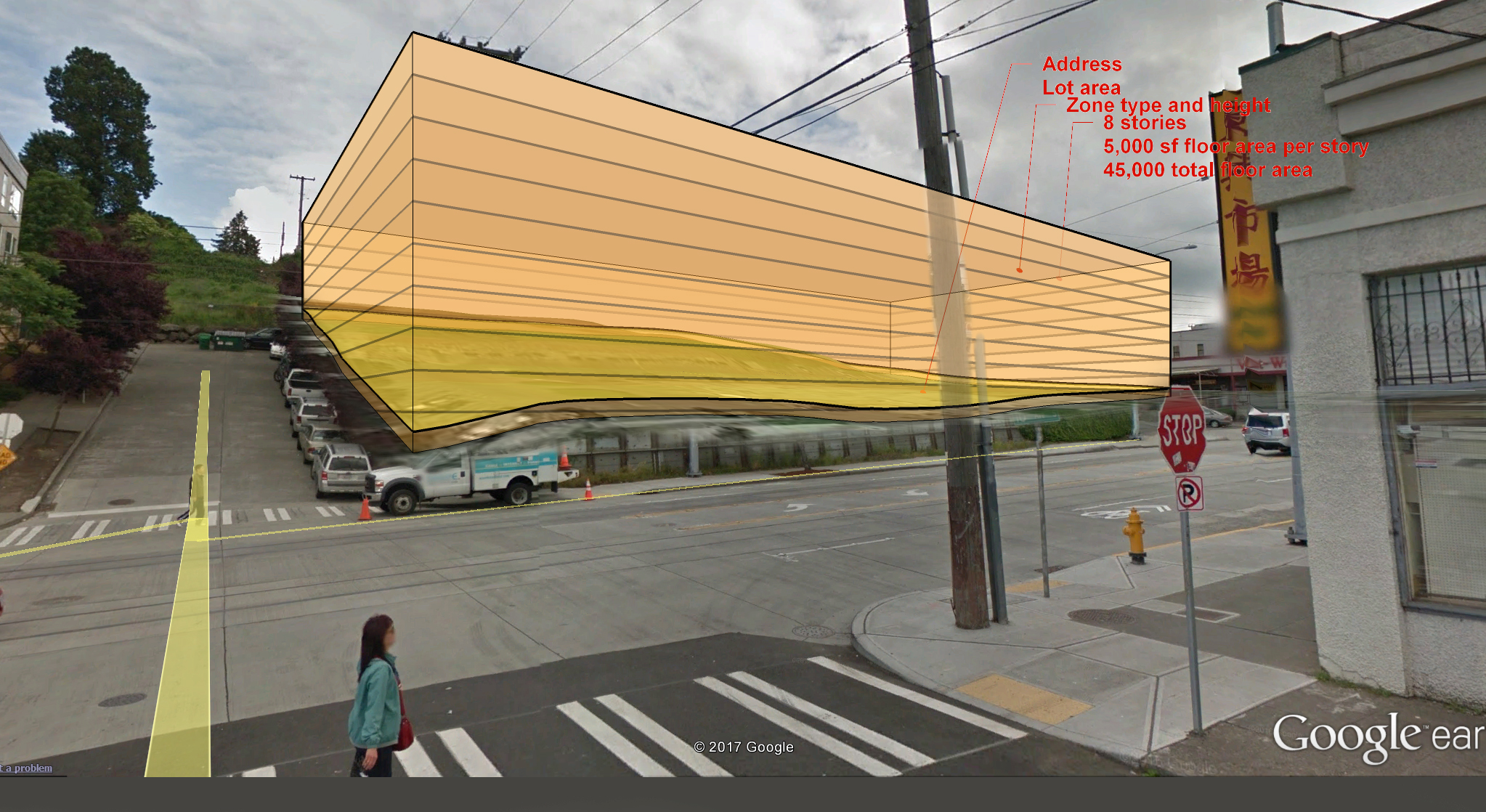
Pull Jurisdictional data (Seattle’s Open City Dataset)
- Lot lines (form profiles, and visible lot boundary line)
- Zoning height (form heights)
- Zoning map color (form color)
- Police Crime data
- Location based AR Anchor